Fault Block Mountains Explained: Hiking Guide

Fault block mountains, majestic landforms shaped by the Earth's tectonic forces, present unique challenges and rewards for hikers exploring their rugged terrain, and the Basin and Range Province in the Western United States serves as a prime example of this geological phenomenon, offering diverse hiking trails. The United States Geological Survey (USGS) provides detailed geological surveys and maps crucial for understanding the structure of fault block mountains and planning safe hikes, and, for those seeking to deepen their understanding, works such as "Interpreting Earth's History" by J. Zumberge, explain the geological processes involved in forming these mountains, which is essential background knowledge when seeking fault block mountains explained for a comprehensive understanding of their formation and impact on hiking conditions.
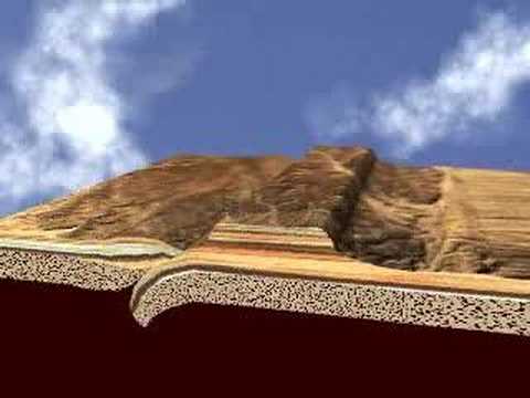
Image taken from the YouTube channel Daniel Izzo , from the video titled How Mountains Form .
Unveiling the Majesty of Fault Block Mountains
Fault block mountains stand as testaments to the Earth's dynamic forces, sculpted by millennia of tectonic activity. These geological formations are not merely scenic wonders, but also windows into the powerful processes that shape our planet's surface. Understanding their origins and characteristics allows us to appreciate the intricate interplay of faulting, uplift, and erosion.
Defining Fault Block Mountains
Fault block mountains are distinctive landforms characterized by their steep, often dramatic, slopes on one side and gentler slopes on the other.
They are created primarily through faulting, a process where large blocks of the Earth's crust are displaced along fractures known as faults. This displacement results in the uplift of some blocks and the subsidence of others, giving rise to the characteristic asymmetry of these mountains.
Faulting: The Primary Sculptor
Faulting is the driving force behind the formation of fault block mountains. Specifically, normal faults play a crucial role.
Normal faults occur when the Earth's crust is subjected to extensional forces, causing one block to slide downwards relative to the adjacent block. This downward movement creates a graben, a valley-like depression flanked by elevated blocks known as horsts.
The cumulative effect of numerous parallel normal faults can create extensive mountain ranges with a distinctive "blocky" appearance.
Tectonic Forces: The Grand Architects
The formation of fault block mountains is intrinsically linked to the movement of tectonic plates.
Extensional forces, often associated with plate divergence or rifting, generate the stress necessary to initiate faulting. As tectonic plates pull apart, the crust stretches and thins, leading to the development of normal faults.
This process can occur over vast regions, resulting in the formation of extensive fault block mountain systems.
Horst and Graben: The Building Blocks
The horst and graben structure is the fundamental element of fault block mountain landscapes.
A horst represents an uplifted block of crust bounded by normal faults on either side. These elevated blocks form the mountain ranges themselves, rising dramatically above the surrounding terrain.
Conversely, a graben is a down-dropped block, creating valleys or basins that separate the horsts. The interplay of horsts and grabens creates the characteristic ridge-and-valley topography associated with fault block mountains.
Iconic Examples: Windows into Earth's History
Several prominent examples of fault block mountains exist worldwide, showcasing the diversity and scale of these geological formations.
The Sierra Nevada in California is a classic example, with its imposing eastern escarpment and gentle western slope. The Basin and Range Province in the western United States, encompassing regions like Death Valley and Great Basin National Park, is another notable example, characterized by its numerous parallel mountain ranges and valleys.
These regions offer invaluable opportunities to study the processes that shape our planet and appreciate the awe-inspiring beauty of fault block mountains.
The Geological Forces at Play: Tectonics, Uplift, and Erosion
Fault block mountains stand as testaments to the Earth's dynamic forces, sculpted by millennia of tectonic activity. These geological formations are not merely scenic wonders, but also windows into the powerful processes that shape our planet's surface. Understanding their origins and characteristics allows us to appreciate the complex interplay of tectonics, uplift, and erosion that define these landscapes.
Tectonic Plates and the Dance of Extension
The Earth's lithosphere is fragmented into tectonic plates, which are constantly in motion. These plates interact in various ways: colliding, sliding past each other, or diverging. Fault block mountains are primarily formed in regions experiencing extensional tectonics, where the crust is being stretched and thinned.
This stretching can be visualized as pulling apart a piece of taffy. As the crust is pulled, it becomes weaker and more prone to fracturing. This is where faults, the defining feature of fault block mountains, come into play.
Stress, Strain, and the Birth of Faults
The constant movement of tectonic plates generates stress within the Earth's crust. This stress accumulates over time, causing rocks to deform. The deformation is called strain. When the stress exceeds the rock's strength, it fractures, creating a fault.
In the case of fault block mountains, the dominant type of fault is the normal fault. This occurs when the hanging wall (the block above the fault plane) moves downward relative to the footwall (the block below the fault plane). This downward movement is a direct consequence of the extensional forces at work.
Horst and Graben: The Building Blocks of Fault Block Mountains
The repetitive action of normal faulting creates the characteristic horst and graben topography. A horst is an uplifted block bounded by two normal faults. It forms the mountain range itself.
Conversely, a graben is a down-dropped block also bounded by two normal faults. Grabens form valleys or basins between the horsts.
The interplay of horsts and grabens is fundamental to the formation of fault block mountain landscapes. The uplifted horsts become mountains, while the down-dropped grabens become valleys, creating dramatic topographic relief.
Uplift and the Sculpting Power of Erosion
While tectonic forces initiate the formation of fault block mountains through uplift, erosion plays a crucial role in sculpting the final landscape. As the horsts are uplifted, they are immediately subjected to weathering and erosion by wind, water, and ice.
Erosion wears down the uplifted blocks.
This constant interplay between uplift and erosion shapes the mountain range over geological timescales. The rate of erosion influences the steepness of the mountain slopes, the depth of the valleys, and the overall appearance of the landscape. Over time, erosion can significantly modify the initial fault block structure, creating the diverse and captivating scenery we admire today.
Iconic Examples: Exploring the World's Fault Block Mountains
Fault block mountains stand as testaments to the Earth's dynamic forces, sculpted by millennia of tectonic activity. These geological formations are not merely scenic wonders, but also windows into the powerful processes that shape our planet's surface. Understanding their origins and characteristics is best achieved by exploring some of the most iconic examples found across the globe.
North American Giants: Sierra Nevada and the Basin and Range
North America boasts some of the most impressive fault block mountain ranges in the world. Among these, the Sierra Nevada in California and the sprawling Basin and Range Province stand out as prime examples of the power of tectonic forces.
Sierra Nevada: A Monument to Uplift and Erosion
The Sierra Nevada, a majestic mountain range stretching along the eastern edge of California, is a classic example of a tilted fault block. Its dramatic eastern escarpment, rising sharply from the Owens Valley, testifies to the magnitude of the faulting that occurred.
The range's gradual western slope, on the other hand, reflects the long, slow uplift and subsequent erosion that has shaped the landscape over millions of years. Granite, the dominant rock type, has been sculpted by glaciers and rivers, creating iconic features like Yosemite Valley.
The Sierra Nevada's geological history is intricately linked to the tectonic activity along the western margin of the North American continent. The range's uplift began in the Cenozoic Era, driven by the interplay of plate tectonics and the formation of the Basin and Range Province to the east.
Basin and Range: A Landscape of Extension
East of the Sierra Nevada lies the Basin and Range Province, a vast region characterized by a series of parallel mountain ranges (horst) and valleys (graben). This landscape is a direct result of crustal extension, where the Earth's crust has been stretched and thinned, leading to widespread faulting.
Death Valley, one of the hottest and driest places on Earth, is a prominent example of a graben within the Basin and Range. Its extreme environment and dramatic topography offer a stark reminder of the geological forces at play.
Great Basin National Park, also located within the province, showcases the beauty and diversity of this unique landscape. From towering peaks to ancient bristlecone pine forests, the park provides a glimpse into the ecological resilience of life in the face of geological challenges.
European Counterparts: Harz Mountains and Vosges Mountains
While North America may be renowned for its fault block mountains, Europe also features notable examples, albeit on a smaller scale. The Harz Mountains in Germany and the Vosges Mountains in France offer insights into the diverse ways in which faulting and erosion can shape a landscape.
Harz Mountains: A German Upland
The Harz Mountains, located in central Germany, represent a classic example of a horst mountain range. Rising from the surrounding lowlands, the Harz Mountains have experienced significant uplift along fault lines.
The range's geological history is complex, involving multiple phases of tectonic activity and erosion. The Brocken, the highest peak in the Harz, is a popular destination for hikers and nature enthusiasts.
Vosges Mountains: A French Ridge
Across the Rhine River in France, the Vosges Mountains offer another perspective on fault block mountain formation. Similar to the Harz, the Vosges Mountains have been uplifted along fault lines, creating a distinct ridge-like range.
The Vosges are known for their forested slopes, picturesque villages, and historical significance. They provide a valuable contrast to the North American examples, illustrating the regional variations in fault block mountain formation and evolution.
Protecting the Landscape: The Role of Conservation Agencies
In North America, organizations like the National Park Service (NPS) and the United States Forest Service (USFS) play a crucial role in managing and protecting these fragile environments.
The NPS oversees national parks like Yosemite and Great Basin, preserving their natural and cultural resources for future generations. The USFS manages national forests within fault block mountain regions, balancing resource extraction with conservation efforts.
These agencies work to ensure that visitors can enjoy these iconic landscapes responsibly, minimizing their impact on the environment. Their efforts are essential for maintaining the ecological integrity and scenic beauty of fault block mountains for years to come.
Planning Your Adventure: A Practical Guide to Exploring Fault Block Mountains
Fault block mountains stand as testaments to the Earth's dynamic forces, sculpted by millennia of tectonic activity. These geological formations are not merely scenic wonders, but also windows into the powerful processes that shape our planet's surface. Understanding their origins and characteristics enhances the experience of exploring them. But even with knowledge, proper planning is paramount for a safe and enriching adventure. Here’s a practical guide to help you navigate and appreciate these magnificent landscapes responsibly.
Essential Resources: Maps, Weather, and Information
Venturing into fault block mountain terrain requires meticulous preparation, and access to reliable information is the bedrock of any successful expedition. You will have to be prepared before venturing forth.
Geological and topographic maps are indispensable tools. These maps provide critical insights into the terrain's elevation changes, geological composition, and hydrological features.
Understanding the underlying geology informs your awareness of potential hazards, such as unstable slopes or rockfall zones. Topographic maps, on the other hand, are critical for navigation.
They help you to identify landmarks, plan routes, and estimate the difficulty of your trek.
Consulting weather forecasts is equally crucial. Mountain weather can be notoriously unpredictable, with conditions changing rapidly.
Be sure to check forecasts from multiple sources and be prepared for sudden shifts in temperature, precipitation, and wind. Understanding the prevailing weather patterns for the specific region and season is also beneficial.
Additionally, research the specific regulations and permit requirements for the area you plan to visit. Many protected areas, like those managed by the National Park Service (NPS) and United States Forest Service (USFS), require permits for certain activities.
These can include backcountry camping or hiking in sensitive areas. Familiarize yourself with these regulations to ensure compliance and minimize your impact on the environment.
Mastering Navigation: Maps, Compass, and GPS
Once you've gathered essential resources, mastering navigation techniques is the next critical step. While modern technology offers convenient tools, reliance on traditional methods is also wise.
The Art of Map and Compass Navigation
A map and compass remain reliable navigation tools, independent of batteries or cell service.
Develop proficiency in using a compass to orient yourself on a map and take bearings. Learn to interpret topographic maps to identify landforms and plan your route accordingly.
Practice these skills in familiar environments before venturing into more remote areas.
Harnessing GPS Technology
GPS devices and smartphone apps offer valuable navigational assistance, pinpointing your location and displaying detailed maps.
However, remember that these devices are not infallible. Batteries can die, and signal reception can be unreliable in deep canyons or dense forests.
Always carry a backup power source and a physical map and compass as a safety net. Familiarize yourself with the app or device's functions.
Learn how to download offline maps and use it to track your route.
Safety First: Water, Wildlife, and Permits
Safety should always be paramount. Especially when exploring fault block mountains, with their unique challenges and potential hazards.
Hydration and Weather Awareness
Carry an adequate supply of water and know how to find and purify water sources. Dehydration can quickly become a serious issue, particularly in arid environments.
Be aware of the signs of heat exhaustion and heatstroke. Familiarize yourself with treatment protocols.
Understanding weather patterns and potential hazards associated with each season is equally important. Prepare accordingly.
Respecting Wildlife and Securing Permits
Fault block mountain regions are home to diverse wildlife, some of which may pose a threat to human safety. Learn about the animals that inhabit the area you plan to visit.
Store food properly to avoid attracting animals to your campsite, and never approach or feed wildlife. Be aware of permit requirements, as mentioned earlier, and adhere to all regulations to protect both yourself and the environment.
Leave No Trace: Ethical Hiking Practices
Beyond personal safety, responsible exploration requires a commitment to minimizing your impact on the environment.
The Seven Principles
Adhering to the Leave No Trace Principles is essential for preserving the integrity of fault block mountain ecosystems. These principles include:
- Planning ahead and preparing
- Traveling and camping on durable surfaces
- Disposing of waste properly
- Leaving what you find
- Minimizing campfire impacts
- Respecting wildlife
- Being considerate of other visitors
By following these guidelines, you can ensure that your visit leaves a minimal footprint and that future generations can enjoy the same pristine landscapes.
Exploring fault block mountains offers an unparalleled opportunity to connect with nature and witness the power of geological forces. By prioritizing safety, mastering navigation techniques, and adhering to ethical hiking practices, you can embark on an adventure that is both enriching and responsible.
Video: Fault Block Mountains Explained: Hiking Guide

FAQs: Fault Block Mountains Explained
What makes a fault block mountain different from other types of mountains?
Fault block mountains are formed by tectonic forces that cause large blocks of the Earth's crust to uplift along faults. Other mountains might be formed by volcanic activity or folding of the earth. So, what makes fault block mountains explained is the block-like appearance caused by this faulting and uplift.
Are fault block mountains generally safe for hiking?
Generally, yes, but caution is always needed when hiking. The steep slopes common in fault block mountains explained can present challenges. Be aware of potential rockfalls and unstable terrain and check weather forecasts.
Can you give some examples of famous fault block mountain ranges?
The Sierra Nevada range in California and the Harz mountains in Germany are well-known examples of fault block mountain ranges. These ranges beautifully illustrate how faulting shapes the landscape as fault block mountains explained, with their distinctive tilted blocks.
Why are fault block mountains often associated with arid or semi-arid regions?
The formation of fault block mountains explained can create rain shadows. As moist air rises over one side, it releases its moisture, leaving the other side drier. This effect, combined with the geological processes that form these mountains, often contributes to arid or semi-arid climates in their vicinity.
So, there you have it – fault block mountains explained! Hopefully, you're feeling inspired to lace up your boots and explore these geological wonders firsthand. Whether you're an experienced hiker or just starting out, remember to respect the landscape and enjoy the incredible views these unique mountains have to offer. Happy trails!
